Land Use Visualization using Angular and the Canvas element
Software for Housing, Part 2
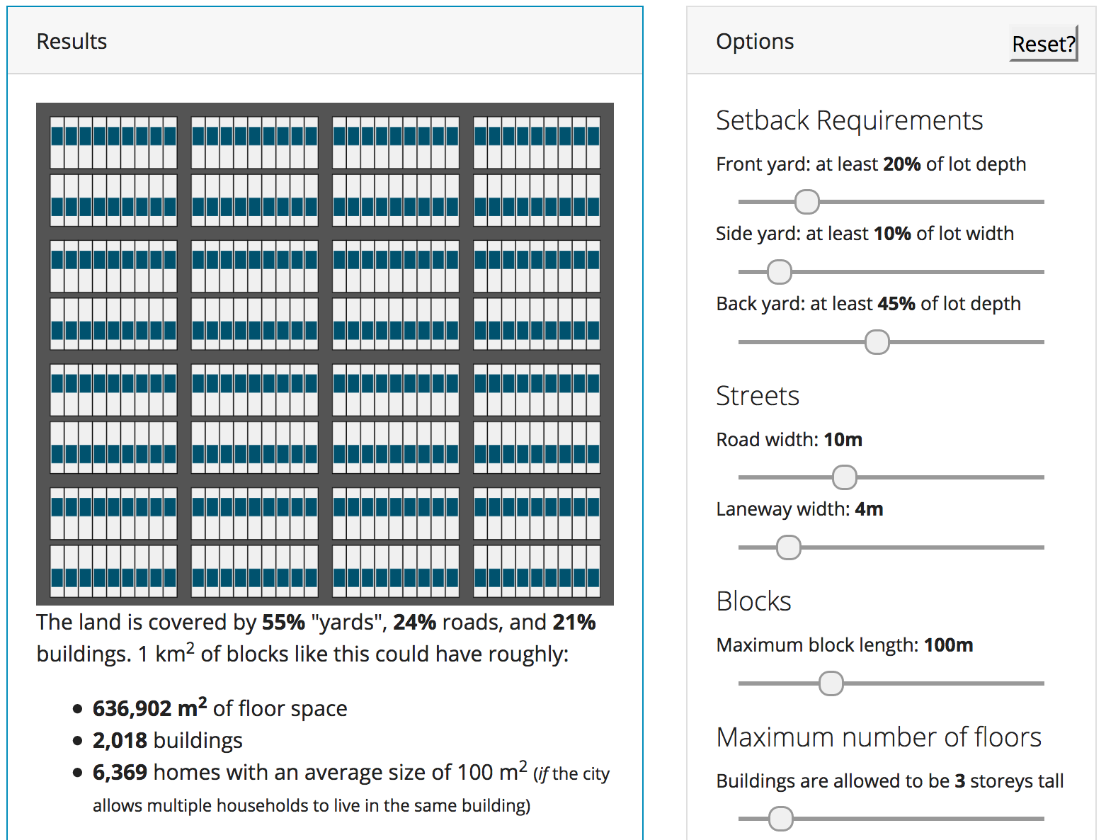
I recently built a web tool to solve a simple question that comes up often in urban planning: after taking setback requirements into account, how much of lot can be built on? The answer is often surprising: for example, Vancouver’s most common residential zone only allows houses to cover about 28% of the land.
It was a fun weekend project, and a few weeks later I decided to upgrade it on a long plane ride. It’s now a neighbourhood-level simulator with many more parameters:
These are mobile and desktop-friendly, and the visualization is entirely done in the browser. Here’s how it all works.


